Indian Head Lighthouse

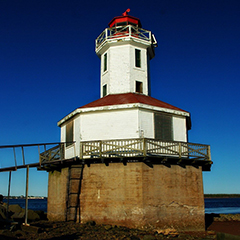
The Indian Head Lighthouse has one of the most unique shapes of any Prince Edward Island Lighthouse.
It is completely octagonal, from the concrete base to the lantern.The keeper's dwelling is at the base, and a tower and lantern rise from the centre of the dwelling's roof.The dwelling has 12' sides and an inside diameter of 26.5'. The tower has sides 5' wide with an inside diameter of 10'. There is a wooden railing at both the gallery and dwelling level. The railing is designed with basic upright post with cross braces in between. The roof of the dwelling and the lantern are both painted red. The lantern deck is surrounded by a wooden decorative cornice, and a beautiful cross braced railing around the lantern.
The windows on the dwelling level are protected by metal grills and there is a metal door. Four sides of the tower have two sets of windows. On each side, the upper level windows are tall and narrow, and the lower level of the tower has shorter windows.
When you reach this site at low tide the metal ramp up to the lighthouse is hard to reach. Most of the planks which lead to the ramp have been washed away.
Driving Directions:

Red Sands Shore Drive - From Route 2 on the Central Coastal Drive(south shore) just east of Summerside, turn south onto Route 1A and drive for 10 km (6.3 miles). Turn right onto Route 171 (Callbeck Street), and then after 1.9 km (1.2 miles) turn right on Route 112 towards Lower Bedeque. Follow Route 112 to its end where you will see the Indian Head Lighthouse at the end of the breakwater. At low tide it is sometimes possible to walk out to the lighthouse..
GPS Coordinates: 46 22 47N 63 49 01.1W
Technical Data
- Status: Active
- FHBRO Number: 90-109
- LOL number: 1020
- Date Built: 1881
- Nominal Range: 10 NAUTICAL MILES
- Focal Height: 14 METERS
- Light: ISO white
- Flash Pattern: Flash 5seconds Eclipse 5seconds
- Tower height: 12.9m, 42'3"
Historic Data
Indian Head Lighthouse FBRO# 90-109 report states:
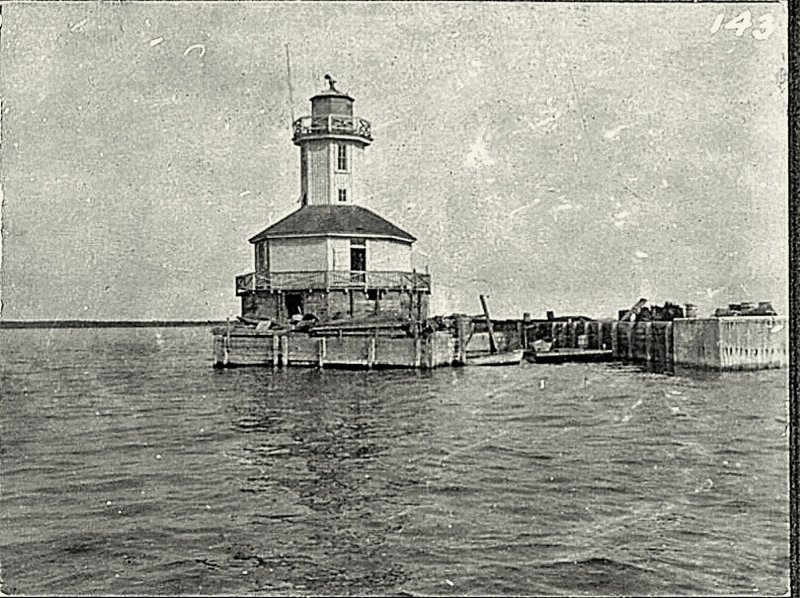
" According to a brief entry in the Department of Marine's Annual Report for 1881, the site originally consisted only of a 'circular pier.' The exact date in which the breakwater was constructed is unknown but the Department of Marine's Annual Report for 1893 states that the 'North end breakwater was close piled and lumber put in' and that 'iron clamps were put on the corners to bind it securely.' Brush and stone were brought in to fill the space between the iron caisson and the breakwater."
This led to a wharf like structure around the lighthouse and the creation of a small slip for rowboats. (This is visually shown by the photo below)

A very early Coast Guard photo (above) shows the dwelling has two storeys. It shows a small window and door which leads to the wooden deck which surrounded the lighthouse. Today this lower portion is concrete with no outside openings.
Early recollections state that when it was built, the surface of the breakwater was so level that a horse and wagon could travel on it.Today it is so uneven, one cannot safely walk on it.
One report had the following information, that the dwelling had a kitchen, bedroom, hall, storage and no windows in this level. Another report has living room and no hall.
Keepers rowed over from Summerside in the late afternoon, spent the night and rowed back to land in the morning.
Lighthouse Keepers
1881 - Charles Peters - Died within a year of the light being built.
1881-1898 - James Walsh
1898-1913 - Joel S. Allen
1913-1924 - F. W. Peters
1924-19?? - M. Gallant
1925-1927 - A. E. Grady
1927-1928 - C. Gallant
1928-19?? - Amos A. Gallant
Current Owners/ Operators:
The Government of Canada owns this lighthouse. The City of Summerside has submitted a petition for ownership to the Parks Canada Heritage Lighthouse Program.
Special Event:
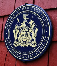
On September 25th 2013, the lighthouse was awarded a Provincial Designated Heritage Place plaque and certificate from the Honourable Minister of Tourism and Culture, Robert Henderson.

There was no representative at the presentation.
