Annandale Back Range
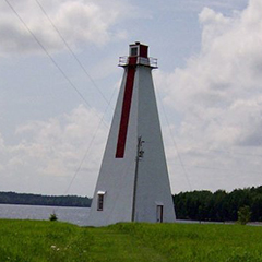
Annandale Back Range Light - The present tower was built in 1901. It began as a square skeleton tower which was later sheathed and shingled.
The tower is 18.8m(65'.6") which makes it the highest range light on Prince Edward Island. Facing the channel, there is a red vertical daymark on the upper 2/3 of the tower. There is a wood post foundation. The base of the square tower is 6.8m (22'.3" ) and it tapers to 1.68m (5'.5" ) at the top. There are heavy metal cables on all sides from the upper part of the tower to the ground to stablize this structure. In common with most range lights, the interior is not finished.
The interior of this tower is not divided into floors; instead there are narrow steep stairs with several small platforms where the keeper rested as he carried oil to the top.
This light is visible on the line of range and operates at night only. It is located on private land and is maintained by the Candian Coast Guard from April to December.
Severe erosion on Juniper Point threatens this range light.
Driving Directions:
![]()
Points East Coastal Drive - Turn off route # 4 onto Route # 310 at Dundas Corner. Continue for approx 8 km . At this point you can choose to turn right at a clay road called 'Lighthouse Road,' or continue a little farther to a paved road on the right called ' Nortons Road'. If you take the Nortons Road, you can follow it until you reach a corner called 'River Road.'This ia a great spot for photos. Also this road continues to the shore close-by giving you a great shore view of this range light.
GPS Coordinates: 46 15 32.9 N 62 25 19.8 W - (on Juniper Point 303 degrees, 50 minutes 1376 M from front range, on Banks Point on Boughton Bay.)
Technical Data
- Status: Active
- FHBRO Number: 90-282
- LOL number: 950
- Date Built: 1901
- Electrification and De-staffing Dates: unknown
- Nominal Range: 18 NAUTICAL MILES
- Focal Height: 23.2m, 76'1"
- Light: White light with ISO Equal Interval flash.
- Flash Pattern: Flash 4 seconds Eclipse 4 seconds
- Tower height: 20.0m, 65'6"
Historic Data
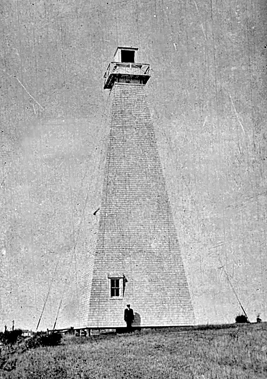
The 1898 tower was a white tapered wooden skeleton tower, surmounted by an enclosed wooden lantern. The side of the tower facing the channel was slatted to make it more conspicuous. It was 17m (56ft) tall. In October 11, 1900 the back range was toppled by a gale.
Lighthouse Keepers
1898-1912 - Alfred Robertson
1912-1922 - James Norton
1922-19?? - A. Robertson
Current Owners/ Operators:
Government of Canada. The St Peter's Development Corporation has submitted a petition for ownership under the Parks Canada Heritage Lighthouse Program.